Satellite Data Services Market
Satellite Data Services Market Forecasts to 2028 - Global Analysis By Vertical (Energy & Power, Academic & Research, Maritime and Other verticals), Service (Data Analytics and Image Data), Deployment (Hybrid Cloud, Private Cloud and Public Cloud), End User and Geography

|
Years Covered |
2020-2028 |
|
Estimated Year Value (2022) |
US $9.43 BN |
|
Projected Year Value (2028) |
US $35.15 BN |
|
CAGR (2022 - 2028) |
24.5% |
|
Regions Covered |
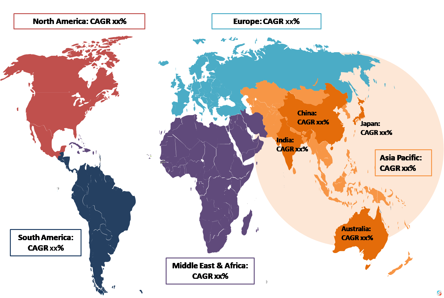
North America, Europe, Asia Pacific, South America, and Middle East & Africa |
|
Countries Covered |
US, Canada, Mexico, Germany, UK, Italy, France, Spain, Japan, China, India, Australia, New Zealand, South Korea, Rest of Asia Pacific, South America, Argentina, Brazil, Chile, Middle East & Africa, Saudi Arabia, UAE, Qatar, and South Africa |
|
Largest Market |
North America |
|
Fastest Growing Market |
Asia Pacific |
According to Stratistics MRC, the Global Satellite Data Services Market is accounted for $9.43 billion in 2022 and is expected to reach $35.15 billion by 2028 growing at a CAGR of 24.5% during the forecast period. Satellite data service is the process of gathering information about the Earth from man-made satellites in various orbits. Satellites transmit data on the planet's surface and weather. Satellite data services are concerned with the capture of photographs of Earth or other planets using imaging satellites. Commercial satellite imaging is the use of these images for commercial reasons, which covers applications such as environmental monitoring and management, energy resource security, border surveillance, and building project mapping. Earth observation is the major use of satellite data (EO). It transmits information on the earth's surface, meteorological, chemical, and biological changes. Satellite data is generated using remote sensing technologies like Synthetic Aperture Radar (SAR) and Real Aperture Radar (RAR), which provide a consistent and timely data stream.
According to SIPRI, total global military spending increased by 0.7 percent in real terms in 2021, reaching USD 2.1 trillion.
Market Dynamics:
Driver:
Increase in the demand for satellite imagery data
The growing demand for satellite imaging in industries such as construction, oil and gas, agriculture, mining, and others is expected to drive market growth. There are several advantages to using satellite imaging in the building industry. With the use of high-resolution satellite photos, infrastructure projects can become more detail-oriented, and the satellite data can provide a graphical reference for planners and engineers, resulting in greater accuracy in their construction. Similarly, satellite imaging could be utilised in the mining industry to get data-based information on the mineral potential of a given area during the pre-feasibility and feasibility phases of mineral extraction. These elements are expected to boost the expansion of the satellite data services market.
Restraint:
Strict regulations
Government policies at both the national and international levels have an impact on the evolution of the satellite data services ecosystem and business, either directly or indirectly. Government limits on data collection, location privacy, intellectual property rights, and the use and storage of geospatial data and information may hamper market growth throughout the projection period. Furthermore, due to niche and advanced technologies such as high-resolution remote sensing, powerful satellite analytics software, and others, the high capital investment required in satellite-based data services is likely to impede market expansion throughout the projection period.
Opportunity:
Increasing Adoption of AI, Machine Learning, and Cloud Computing in the Space Sector
Prior to the introduction of AI-based platforms, social, industrial, and economic processes, among others, were unreachable. Additionally, utilising daily satellite data, Machine Learning (ML) approaches are being used to identify and locate objects, find geographic and topographic characteristics, and follow minute changes over time. Furthermore, automated machine learning and artificial intelligence (AI) algorithms can successfully distinguish a wide range of earthly things seen from space, such as cars in parking lots, crop yield, and geo sensing in agricultural areas. Cloud computing allows businesses to access previous data for analysis. Artificial intelligence and machine learning can also monitor and analyse satellite-based aerial pictures. Thus, the surge in the space industry's adoption of artificial intelligence (AI) and machine learning (ML) has created several opportunities for the satellite data services market to expand.
Threat:
Concern over space debris
Space debris is the uncontrolled and unwanted fall of no longer operable space ships or pieces of any size onto Earth. The number of variably characterised objects in orbit around the Earth has expanded dramatically since the beginning of human operations in space, and the trend is currently greater than ever with the new wave of small satellites. According to NASA and the European Space Agency, nearly 150 million objects with a combined weight of more than 5,000 tonnes are circling between lower earth orbit (LEO) up to 10,000 km from the planet's surface and geostationary earth orbit (GEO) above this mark.
Covid-19 Impact
COVID-19 was declared a pandemic by the World Health Organization, resulting in travel restrictions and financial market disruption, as well as a detrimental impact on supply chains and production levels. The COVID-19 epidemic had a negative impact on the satellite data services business, as it did on most other industries. Furthermore, as a result of the lockdown, numerous design, development, and manufacturing facilities with insufficient operational launch stations are limiting market expansion during the pandemic. According to Daniel Kim, KTSAT's managing director of Oversea Business, the satellite service provider is having difficulty dealing with the COVID-19 epidemic, since clients and partners have experienced delays in completing contracts and paying payments.
The environment segment is expected to be the largest during the forecast period
The environment segment is estimated to have a lucrative growth, due to the need for high-resolution earth images to accurately map wildlife populations, track illegal mining, and detect deforestation trends. The goal of satellite data services is to comprehend and analyse global environmental conditions as well as geographical information. The increased acceptance and exploitation of earth observation satellites are the primary forces driving market growth for satellite data services in the environment sector. Satellite imaging and image-enhancing equipment such as high-resolution cameras and enhanced remote-sensing technologies have improved satellite-based environmental observation images, propelling satellite data service market share.
The image data segment is expected to have the highest CAGR during the forecast period
The image data segment is anticipated to witness the fastest CAGR growth during the forecast period. Image data collection comprises multiple stages of acquiring information in the form of images via imaging satellites. This gives geospatial information and data in the form of real-time photos. Increased adoption of location-based services (LBS) by a wide range of end-users, including commercial organisations, government, defence, civil engineering, forestry and agriculture, insurance, and energy, is expected to drive market growth. The growing demand for high-resolution satellite imagery in emergency services, homeland defence, data evaluation, and other applications is projected to boost the image data satellite services market.
Region with highest share:
North America is projected to hold the largest market share during the forecast period owing to the multiple government entities in the region that are making significant investments to facilitate the deployment of commercial satellites. The satellite data service market in North America is likely to be driven by advanced infrastructure for space projects and the earliest and most widespread adoption of commercial satellite imagery across a wide range of sectors. Furthermore, growing concerns about satellite-based surveillance create major growth opportunities for the North American market.
Region with highest CAGR:
Asia Pacific is projected to have the highest CAGR over the forecast period, owing to the governments of various countries, including India and China, to strengthen their respective nations' agriculture and defense sectors. Increased adoption of satellite imaging and data analytics by governments such as India and China to aid in urban infrastructure development and planning, as well as to monitor ocean and agricultural under precision agriculture modules, boosts the growth of the satellite data service industry.
Key players in the market
Some of the key players profiled in the Satellite Data Services Market include Airbus Defense and Space, LAND INFO Worldwide Mapping LLC, Satellite Imaging Corporation, Planet Labs Inc, DigitalGlobe, ICEYE, Space Exploration Technologies Corp. (SpaceX), ImageSat International N.V., Satpalda Geospatial Services, Ursa Space Systems, Trimble Inc. , Maxar Technologies, East View Geospatial Inc., Blacksky, L3Harris Technologies, Inc.
Key Developments:
In July 2022, Airbus SAS has been contracted to deliver 42 satellite platforms and services to Northrop Grumman for the US Space Development Agency's Trache 1 Transport layer prototype constellation award.
In June 2020, L3Harris extended its agreement with exactEarth Ltd., a leading provider of Satellite-AIS data services. The agreement aimed to provide exactEarth with a reduced and simplified cost structure for L3Harris’ Satellite-AIS data services. The agreement also provides additional growth opportunities to both parties and further strengthens the latter company’s alliance with L3Harris in delivering advanced high-performance satellite maritime service capabilities to customers around the world.
In February 2020, L3Harris signed an agreement with The Air Force Life Cycle Management Center. The agreement aims to develop a software platform that would make it easier for analysts to use artificial intelligence (AI) to identify objects in large data sets.
In August 2019, Trimble introduced the Trimble T7 tablet for GIS data collection applications. This next-generation tablet connects to Trimble’s suite of survey instruments and Global Navigation Satellite System (GNSS) receivers and streamlines the flow of geospatial data between the office and field for maximum productivity and efficiency.
Verticals Covered:
• Energy & Power
• Academic & Research
• Maritime
• Forestry
• Insurance
• Defense & Security
• Agriculture
• Environmental & Weather
• Engineering & Infrastructure
• Other verticals
Services Covered:
• Data Analytics
• Image Data
Deployments Covered:
• Hybrid Cloud
• Private Cloud
• Public Cloud
End Users Covered:
• Commercial
• Government & Military
Regions Covered:
• North America
o US
o Canada
o Mexico
• Europe
o Germany
o UK
o Italy
o France
o Spain
o Rest of Europe
• Asia Pacific
o Japan
o China
o India
o Australia
o New Zealand
o South Korea
o Rest of Asia Pacific
• South America
o Argentina
o Brazil
o Chile
o Rest of South America
• Middle East & Africa
o Saudi Arabia
o UAE
o Qatar
o South Africa
o Rest of Middle East & Africa
What our report offers:
- Market share assessments for the regional and country-level segments
- Strategic recommendations for the new entrants
- Covers Market data for the years 2020, 2021, 2022, 2025, and 2028
- Market Trends (Drivers, Constraints, Opportunities, Threats, Challenges, Investment Opportunities, and recommendations)
- Strategic recommendations in key business segments based on the market estimations
- Competitive landscaping mapping the key common trends
- Company profiling with detailed strategies, financials, and recent developments
- Supply chain trends mapping the latest technological advancements
Free Customization Offerings:
All the customers of this report will be entitled to receive one of the following free customization options:
• Company Profiling
o Comprehensive profiling of additional market players (up to 3)
o SWOT Analysis of key players (up to 3)
• Regional Segmentation
o Market estimations, Forecasts and CAGR of any prominent country as per the client's interest (Note: Depends on feasibility check)
• Competitive Benchmarking
o Benchmarking of key players based on product portfolio, geographical presence, and strategic alliances
Table of Contents
1 Executive Summary
2 Preface
2.1 Abstract
2.2 Stake Holders
2.3 Research Scope
2.4 Research Methodology
2.4.1 Data Mining
2.4.2 Data Analysis
2.4.3 Data Validation
2.4.4 Research Approach
2.5 Research Sources
2.5.1 Primary Research Sources
2.5.2 Secondary Research Sources
2.5.3 Assumptions
3 Market Trend Analysis
3.1 Introduction
3.2 Drivers
3.3 Restraints
3.4 Opportunities
3.5 Threats
3.6 End User Analysis
3.7 Emerging Markets
3.8 Impact of Covid-19
4 Porters Five Force Analysis
4.1 Bargaining power of suppliers
4.2 Bargaining power of buyers
4.3 Threat of substitutes
4.4 Threat of new entrants
4.5 Competitive rivalry
5 Global Satellite Data Services Market, By Vertical
5.1 Introduction
5.2 Energy & Power
5.2.1 Oil & Gas Operation
5.2.1.1 Pipeline And Transmission Survey
5.2.1.2 Oil And Gas Exploration
5.2.2 Utility
5.2.2.1 Powerline Management
5.2.2.2 Underground Utility Monitoring
5.2.3 Minning & Mineral Exploration
5.2.4 Renewable Energy Sources
5.2.4.1 Hydroelectric Power
5.2.4.2 Solar Energy
5.2.4.3 Wind Energy
5.2.4.4 Other Renewable Energy Sources
5.3 Academic & Research
5.4 Maritime
5.4.1 Illegal Fishing Monitoring
5.4.2 Ports & Harbors Monitoring
5.4.3 Track Activities
5.4.4 Search &Rescue
5.4.5 Coastal Management
5.5 Forestry
5.5.1 Emergency Wild Fire Monitoring
5.5.2 Forest Cover Mapping
5.6 Insurance
5.6.1 Property Damage Estimation
5.6.2 Flood Monitoring
5.7 Defense & Security
5.7.1 Crime Mapping
5.7.2 Critical Infrastructure Protection
5.7.3 Monitoring of Airfields
5.8 Agriculture
5.8.1 Precision Farming
5.8.2 Crop Type Identification
5.9 Environmental & Weather
5.9.1 Weather Forecast
5.9.2 Air & Water Pollution
5.9.3 Natural Disasters
5.9.4 Land Cover And Change Detection
5.10 Engineering & Infrastructure
5.10.1 Industrial and Asset Mapping
5.10.2 Land & Urban Management
5.11 Other verticals
6 Global Satellite Data Services Market, By Service
6.1 Introduction
6.2 Data Analytics
6.2.1 Image Data Processing
6.2.1.1 Aerial Triagulation
6.2.1.2 Pan-Sharpening
6.2.1.3 Orthorectification
6.2.1.4 Cloud Patching
6.2.1.5 Mosaicking
6.2.2 Feature Extraction
6.2.3 Digital Models
6.2.3.1 Digital Elevation Models (DEM)
6.2.3.2 Digital Terrain Models (DTM)
6.2.3.3 Digital Surface Models (DSM)
6.2.4 Classification
6.2.4.1 Object Classification or Identification
6.2.4.2 Land Cover and Change Detection
6.3 Image Data
6.3.1 Spatial
6.3.1.1 Very High Resolution
6.3.1.2 Medium-Low Resolution
6.3.1.3 High Resolution
6.3.2 Spectral
6.3.3 Radiometric
6.3.4 Temporal
7 Global Satellite Data Services Market, By Deployment
7.1 Introduction
7.2 Hybrid Cloud
7.3 Private Cloud
7.4 Public Cloud
8 Global Satellite Data Services Market, By End User
8.1 Introduction
8.2 Commercial
8.2.1 Media and Entertainment
8.2.2 Satellite Operators
8.2.3 Geological Companies
8.2.4 Mining, Oil and Gas Companies
8.2.5 Transport, Construction and Infrastructure Companies
8.2.6 Mapping and Cartographic Companies
8.2.7 Other Commercials
8.3 Government & Military
8.3.1 National Space Agencies
8.3.2 National Mapping& topograpgic Agencies
8.3.3 Academic and Research Institutions
8.3.4 Departments of Defense
8.3.5 National Security Agencies
8.3.6 Departments of Environment & Agriculture
8.3.7 Other Government & Militaries
9 Global Satellite Data Services Market, By Geography
9.1 Introduction
9.2 North America
9.2.1 US
9.2.2 Canada
9.2.3 Mexico
9.3 Europe
9.3.1 Germany
9.3.2 UK
9.3.3 Italy
9.3.4 France
9.3.5 Spain
9.3.6 Rest of Europe
9.4 Asia Pacific
9.4.1 Japan
9.4.2 China
9.4.3 India
9.4.4 Australia
9.4.5 New Zealand
9.4.6 South Korea
9.4.7 Rest of Asia Pacific
9.5 South America
9.5.1 Argentina
9.5.2 Brazil
9.5.3 Chile
9.5.4 Rest of South America
9.6 Middle East & Africa
9.6.1 Saudi Arabia
9.6.2 UAE
9.6.3 Qatar
9.6.4 South Africa
9.6.5 Rest of Middle East & Africa
10 Key Developments
10.1 Agreements, Partnerships, Collaborations and Joint Ventures
10.2 Acquisitions & Mergers
10.3 New Product Launch
10.4 Expansions
10.5 Other Key Strategies
11 Company Profiling
11.1 Airbus Defense and Space
11.2 LAND INFO Worldwide Mapping LLC
11.3 Satellite Imaging Corporation
11.4 Planet Labs Inc
11.5 DigitalGlobe
11.6 ICEYE
11.7 Space Exploration Technologies Corp. (SpaceX)
11.8 ImageSat International N.V.
11.9 Satpalda Geospatial Services
11.10 Ursa Space Systems
11.11 Trimble Inc.
11.12 Maxar Technologies
11.13 East View Geospatial Inc.
11.14 Blacksky
11.15 L3Harris Technologies, Inc.
List of Tables
1 Global Satellite Data Services Market Outlook, By Region (2020-2028) ($MN)
2 Global Satellite Data Services Market Outlook, By Vertical (2020-2028) ($MN)
3 Global Satellite Data Services Market Outlook, By Energy & Power (2020-2028) ($MN)
4 Global Satellite Data Services Market Outlook, By Oil & Gas Operation (2020-2028) ($MN)
5 Global Satellite Data Services Market Outlook, By Pipeline And Transmission Survey (2020-2028) ($MN)
6 Global Satellite Data Services Market Outlook, By Oil And Gas Exploration (2020-2028) ($MN)
7 Global Satellite Data Services Market Outlook, By Utility (2020-2028) ($MN)
8 Global Satellite Data Services Market Outlook, By Powerline Management (2020-2028) ($MN)
9 Global Satellite Data Services Market Outlook, By Underground Utility Monitoring (2020-2028) ($MN)
10 Global Satellite Data Services Market Outlook, By Minning & Mineral Exploration (2020-2028) ($MN)
11 Global Satellite Data Services Market Outlook, By Renewable Energy Sources (2020-2028) ($MN)
12 Global Satellite Data Services Market Outlook, By Hydroelectric Power (2020-2028) ($MN)
13 Global Satellite Data Services Market Outlook, By Solar Energy (2020-2028) ($MN)
14 Global Satellite Data Services Market Outlook, By Wind Energy (2020-2028) ($MN)
15 Global Satellite Data Services Market Outlook, By Other Renewable Energy Sources (2020-2028) ($MN)
16 Global Satellite Data Services Market Outlook, By Academic & Research (2020-2028) ($MN)
17 Global Satellite Data Services Market Outlook, By Maritime (2020-2028) ($MN)
18 Global Satellite Data Services Market Outlook, By Illegal Fishing Monitoring (2020-2028) ($MN)
19 Global Satellite Data Services Market Outlook, By Ports & Harbors Monitoring (2020-2028) ($MN)
20 Global Satellite Data Services Market Outlook, By Track Activities (2020-2028) ($MN)
21 Global Satellite Data Services Market Outlook, By Search &Rescue (2020-2028) ($MN)
22 Global Satellite Data Services Market Outlook, By Coastal Management (2020-2028) ($MN)
23 Global Satellite Data Services Market Outlook, By Forestry (2020-2028) ($MN)
24 Global Satellite Data Services Market Outlook, By Emergency Wild Fire Monitoring (2020-2028) ($MN)
25 Global Satellite Data Services Market Outlook, By Forest Cover Mapping (2020-2028) ($MN)
26 Global Satellite Data Services Market Outlook, By Insurance (2020-2028) ($MN)
27 Global Satellite Data Services Market Outlook, By Property Damage Estimation (2020-2028) ($MN)
28 Global Satellite Data Services Market Outlook, By Flood Monitoring (2020-2028) ($MN)
29 Global Satellite Data Services Market Outlook, By Defense & Security (2020-2028) ($MN)
30 Global Satellite Data Services Market Outlook, By Crime Mapping (2020-2028) ($MN)
31 Global Satellite Data Services Market Outlook, By Critical Infrastructure Protection (2020-2028) ($MN)
32 Global Satellite Data Services Market Outlook, By Monitoring of Airfields (2020-2028) ($MN)
33 Global Satellite Data Services Market Outlook, By Agriculture (2020-2028) ($MN)
34 Global Satellite Data Services Market Outlook, By Precision Farming (2020-2028) ($MN)
35 Global Satellite Data Services Market Outlook, By Crop Type Identification (2020-2028) ($MN)
36 Global Satellite Data Services Market Outlook, By Environmental & Weather (2020-2028) ($MN)
37 Global Satellite Data Services Market Outlook, By Weather Forecast (2020-2028) ($MN)
38 Global Satellite Data Services Market Outlook, By Air & Water Pollution (2020-2028) ($MN)
39 Global Satellite Data Services Market Outlook, By Natural Disasters (2020-2028) ($MN)
40 Global Satellite Data Services Market Outlook, By Land Cover And Change Detection (2020-2028) ($MN)
41 Global Satellite Data Services Market Outlook, By Engineering & Infrastructure (2020-2028) ($MN)
42 Global Satellite Data Services Market Outlook, By Industrial and Asset Mapping (2020-2028) ($MN)
43 Global Satellite Data Services Market Outlook, By Land & Urban Management (2020-2028) ($MN)
44 Global Satellite Data Services Market Outlook, By Other verticals (2020-2028) ($MN)
45 Global Satellite Data Services Market Outlook, By Service (2020-2028) ($MN)
46 Global Satellite Data Services Market Outlook, By Data Analytics (2020-2028) ($MN)
47 Global Satellite Data Services Market Outlook, By Image Data Processing (2020-2028) ($MN)
48 Global Satellite Data Services Market Outlook, By Aerial Triagulation (2020-2028) ($MN)
49 Global Satellite Data Services Market Outlook, By Pan-Sharpening (2020-2028) ($MN)
50 Global Satellite Data Services Market Outlook, By Orthorectification (2020-2028) ($MN)
51 Global Satellite Data Services Market Outlook, By Cloud Patching (2020-2028) ($MN)
52 Global Satellite Data Services Market Outlook, By Mosaicking (2020-2028) ($MN)
53 Global Satellite Data Services Market Outlook, By Feature Extraction (2020-2028) ($MN)
54 Global Satellite Data Services Market Outlook, By Digital Models (2020-2028) ($MN)
55 Global Satellite Data Services Market Outlook, By Digital Elevation Models (DEM) (2020-2028) ($MN)
56 Global Satellite Data Services Market Outlook, By Digital Terrain Models (DTM) (2020-2028) ($MN)
57 Global Satellite Data Services Market Outlook, By Digital Surface Models (DSM) (2020-2028) ($MN)
58 Global Satellite Data Services Market Outlook, By Classification (2020-2028) ($MN)
59 Global Satellite Data Services Market Outlook, By Object Classification or Identification (2020-2028) ($MN)
60 Global Satellite Data Services Market Outlook, By Land Cover and Change Detection (2020-2028) ($MN)
61 Global Satellite Data Services Market Outlook, By Image Data (2020-2028) ($MN)
62 Global Satellite Data Services Market Outlook, By Spatial (2020-2028) ($MN)
63 Global Satellite Data Services Market Outlook, By Very High Resolution (2020-2028) ($MN)
64 Global Satellite Data Services Market Outlook, By Medium-Low Resolution (2020-2028) ($MN)
65 Global Satellite Data Services Market Outlook, By High Resolution (2020-2028) ($MN)
66 Global Satellite Data Services Market Outlook, By Spectral (2020-2028) ($MN)
67 Global Satellite Data Services Market Outlook, By Radiometric (2020-2028) ($MN)
68 Global Satellite Data Services Market Outlook, By Temporal (2020-2028) ($MN)
69 Global Satellite Data Services Market Outlook, By Deployment (2020-2028) ($MN)
70 Global Satellite Data Services Market Outlook, By Hybrid Cloud (2020-2028) ($MN)
71 Global Satellite Data Services Market Outlook, By Private Cloud (2020-2028) ($MN)
72 Global Satellite Data Services Market Outlook, By Public Cloud (2020-2028) ($MN)
73 Global Satellite Data Services Market Outlook, By End User (2020-2028) ($MN)
74 Global Satellite Data Services Market Outlook, By Commercial (2020-2028) ($MN)
75 Global Satellite Data Services Market Outlook, By Media and Entertainment (2020-2028) ($MN)
76 Global Satellite Data Services Market Outlook, By Satellite Operators (2020-2028) ($MN)
77 Global Satellite Data Services Market Outlook, By Geological Companies (2020-2028) ($MN)
78 Global Satellite Data Services Market Outlook, By Mining, Oil and Gas Companies (2020-2028) ($MN)
79 Global Satellite Data Services Market Outlook, By Transport, Construction and Infrastructure Companies (2020-2028) ($MN)
80 Global Satellite Data Services Market Outlook, By Mapping and Cartographic Companies (2020-2028) ($MN)
81 Global Satellite Data Services Market Outlook, By Other Commercials (2020-2028) ($MN)
82 Global Satellite Data Services Market Outlook, By Government & Military (2020-2028) ($MN)
83 Global Satellite Data Services Market Outlook, By National Space Agencies (2020-2028) ($MN)
84 Global Satellite Data Services Market Outlook, By National Mapping& topograpgic Agencies (2020-2028) ($MN)
85 Global Satellite Data Services Market Outlook, By Academic and Research Institutions (2020-2028) ($MN)
86 Global Satellite Data Services Market Outlook, By Departments of Defense (2020-2028) ($MN)
87 Global Satellite Data Services Market Outlook, By National Security Agencies (2020-2028) ($MN)
88 Global Satellite Data Services Market Outlook, By Departments of Environment & Agriculture (2020-2028) ($MN)
89 Global Satellite Data Services Market Outlook, By Other Government & Militaries (2020-2028) ($MN)
Note: Tables for North America, Europe, APAC, South America, and Middle East & Africa Regions are also represented in the same manner as above.
List of Figures
RESEARCH METHODOLOGY
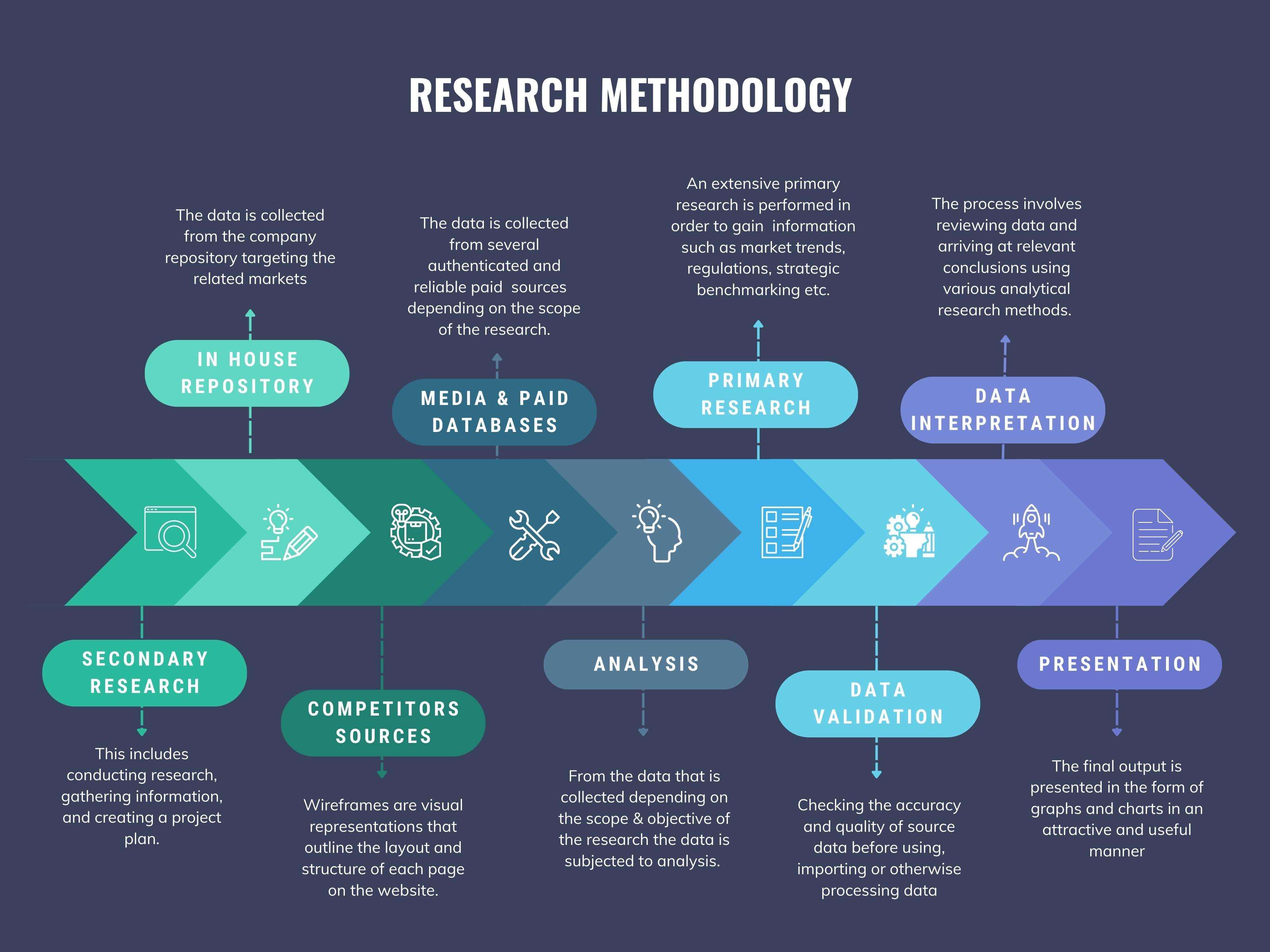
We at ‘Stratistics’ opt for an extensive research approach which involves data mining, data validation, and data analysis. The various research sources include in-house repository, secondary research, competitor’s sources, social media research, client internal data, and primary research.
Our team of analysts prefers the most reliable and authenticated data sources in order to perform the comprehensive literature search. With access to most of the authenticated data bases our team highly considers the best mix of information through various sources to obtain extensive and accurate analysis.
Each report takes an average time of a month and a team of 4 industry analysts. The time may vary depending on the scope and data availability of the desired market report. The various parameters used in the market assessment are standardized in order to enhance the data accuracy.
Data Mining
The data is collected from several authenticated, reliable, paid and unpaid sources and is filtered depending on the scope & objective of the research. Our reports repository acts as an added advantage in this procedure. Data gathering from the raw material suppliers, distributors and the manufacturers is performed on a regular basis, this helps in the comprehensive understanding of the products value chain. Apart from the above mentioned sources the data is also collected from the industry consultants to ensure the objective of the study is in the right direction.
Market trends such as technological advancements, regulatory affairs, market dynamics (Drivers, Restraints, Opportunities and Challenges) are obtained from scientific journals, market related national & international associations and organizations.
Data Analysis
From the data that is collected depending on the scope & objective of the research the data is subjected for the analysis. The critical steps that we follow for the data analysis include:
- Product Lifecycle Analysis
- Competitor analysis
- Risk analysis
- Porters Analysis
- PESTEL Analysis
- SWOT Analysis
The data engineering is performed by the core industry experts considering both the Marketing Mix Modeling and the Demand Forecasting. The marketing mix modeling makes use of multiple-regression techniques to predict the optimal mix of marketing variables. Regression factor is based on a number of variables and how they relate to an outcome such as sales or profits.
Data Validation
The data validation is performed by the exhaustive primary research from the expert interviews. This includes telephonic interviews, focus groups, face to face interviews, and questionnaires to validate our research from all aspects. The industry experts we approach come from the leading firms, involved in the supply chain ranging from the suppliers, distributors to the manufacturers and consumers so as to ensure an unbiased analysis.
We are in touch with more than 15,000 industry experts with the right mix of consultants, CEO's, presidents, vice presidents, managers, experts from both supply side and demand side, executives and so on.
The data validation involves the primary research from the industry experts belonging to:
- Leading Companies
- Suppliers & Distributors
- Manufacturers
- Consumers
- Industry/Strategic Consultants
Apart from the data validation the primary research also helps in performing the fill gap research, i.e. providing solutions for the unmet needs of the research which helps in enhancing the reports quality.
For more details about research methodology, kindly write to us at info@strategymrc.com
Frequently Asked Questions
In case of any queries regarding this report, you can contact the customer service by filing the “Inquiry Before Buy” form available on the right hand side. You may also contact us through email: info@strategymrc.com or phone: +1-301-202-5929
Yes, the samples are available for all the published reports. You can request them by filling the “Request Sample” option available in this page.
Yes, you can request a sample with your specific requirements. All the customized samples will be provided as per the requirement with the real data masked.
All our reports are available in Digital PDF format. In case if you require them in any other formats, such as PPT, Excel etc you can submit a request through “Inquiry Before Buy” form available on the right hand side. You may also contact us through email: info@strategymrc.com or phone: +1-301-202-5929
We offer a free 15% customization with every purchase. This requirement can be fulfilled for both pre and post sale. You may send your customization requirements through email at info@strategymrc.com or call us on +1-301-202-5929.
We have 3 different licensing options available in electronic format.
- Single User Licence: Allows one person, typically the buyer, to have access to the ordered product. The ordered product cannot be distributed to anyone else.
- 2-5 User Licence: Allows the ordered product to be shared among a maximum of 5 people within your organisation.
- Corporate License: Allows the product to be shared among all employees of your organisation regardless of their geographical location.
All our reports are typically be emailed to you as an attachment.
To order any available report you need to register on our website. The payment can be made either through CCAvenue or PayPal payments gateways which accept all international cards.
We extend our support to 6 months post sale. A post sale customization is also provided to cover your unmet needs in the report.
Request Customization
We offer complimentary customization of up to 15% with every purchase. To share your customization requirements, feel free to email us at info@strategymrc.com or call us on +1-301-202-5929. .
Please Note: Customization within the 15% threshold is entirely free of charge. If your request exceeds this limit, we will conduct a feasibility assessment. Following that, a detailed quote and timeline will be provided.
WHY CHOOSE US ?

Assured Quality
Best in class reports with high standard of research integrity

24X7 Research Support
Continuous support to ensure the best customer experience.

Free Customization
Adding more values to your product of interest.

Safe & Secure Access
Providing a secured environment for all online transactions.

Trusted by 600+ Brands
Serving the most reputed brands across the world.